




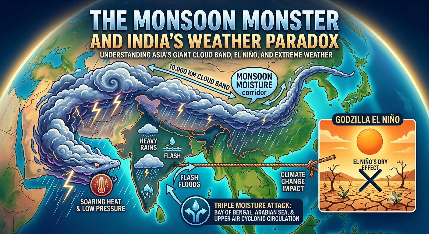
Recently, weather scientists were amazed by a satellite photo showing a massive, 10,000-kilometer line of clouds. This huge white band stretched all the way from India, passed over China, and reached South Korea. Many people on the internet started calling it a “monsoon monster.” But what exactly is happening in our skies?
Not Just One Big Cloud
First, it is important to know that this is not one single, giant cloud. Instead, it is a long chain of many different rain storms linked together.
Here is how it forms: During the summer, India gets incredibly hot. This extreme heat causes the air to rise, creating an invisible empty space (known as low pressure). To fill this space, wet, heavy winds rush in from the Arabian Sea and the Bay of Bengal. At the same time, similar weather patterns happen over East Asia. When these systems line up perfectly, they create a massive “highway” of moisture across the continent. This shows that India’s weather is deeply connected to the rest of Asia.
The El Niño Mystery
For months, experts warned that the world was facing a strong “El Niño.” El Niño happens when the Pacific Ocean gets unusually warm, which normally weakens India’s monsoon winds and causes severe droughts.
So, why is India suddenly covered in clouds and getting heavy rain?
The answer comes down to the difference between long-term climate and short-term daily weather. While El Niño affects the overall season, short-term local weather can still be very strong. Right now, the seas around India are pushing so much moisture into the air that it is temporarily overpowering El Niño’s dry effects.
Why North India is Getting Soaking Wet
Many parts of North India are currently seeing heavy thunderstorms. This sudden change is happening because of three things coming together at once:
- Wet storms blowing in from the Bay of Bengal.
- A constant supply of wet air coming from the Arabian Sea.
- Swirling wind patterns high up in the sky over North India that trap this moisture.
When these three forces crash into each other, they create a massive blanket of clouds over the country.
The Climate Change Warning
While rain might sound like good news for farmers, this specific type of weather is actually a cause for concern. Because the Earth is getting warmer, our oceans are heating up faster than ever. Hotter oceans mean more water evaporates into the sky.
This leads to extreme weather. Instead of getting a gentle, helpful rain spread out over 30 days, we are seeing 30 days’ worth of rain dumping down in just three days. This doesn’t help crops; instead, it causes sudden, destructive floods.
Looking Ahead
This 10,000-kilometer cloud band is a powerful reminder from nature. It proves that weather does not stop at national borders. As global warming continues to change our world, extreme and sudden weather events will become more common. To stay safe and protect our food supply, countries need to rethink how they plan for the monsoon and prepare for a future of unpredictable weather.